 |
|---|
|
| Select from |
*A district in W.B.*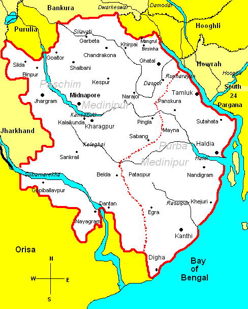
|

Aquainting with the map:On 1st Jan,2002, greater Medinipur was divided into two parts;the eastern part was named East Medinipur;and the western part,West Medinipur. The border between two districts has gone through Dantan, Sabang,Pingla,Debra and Daspur's border.The district West Medinipur has the border with the states Orisa and Jharkhand; and the districts Purulia Bankura and Hooghli.Total area of the district is 7081sq.km. |
||
|---|---|---|---|---|
Index: |
||||
| History | ||||
| Geography | ||||
| Farming | ||||
| Industry | ||||
| Culture | ||||
| Transport | ||||
| Economy | ||||
| ||||
| Page: 2 | Back | Next |